Update 7:35PM 3/21/26: from Custer Sheriff office “We are pleased to inform you that beginning at 7 PM this evening, the roads within the subdivision will be accessible to local residents. However, we kindly request that those who do not live in the area refrain from entering, as the fire is currently about 50% contained. Thank you for your cooperation.”
Update 11:28AM 3/21/2026: from South Dakota Department of Public Safety “Fire activity has slowed after strong strategic efforts yesterday (3/20) and overnight.
Today federal, state and local resources continue working to secure fire lines. They are tracking down and extinguishing hot spots on the fire’s edge. Acres remain at 25 with 0% declared containment.
The goal of last nights air tanker drop of fire retardant was to help prevent any movement to the east.
A burnout operation last evening proactively eliminated available fire fuels in the area between the outer dozer fire line and the interior fire thereby creating a strong fuel break along the fire’s east edge.”
Update 8:43PM: from Qury Fire EOC “Partial Evacuations Lifted for the Sundance Fire. Mountain Lion Rd to Lone Elk remain closed. All other roads are open. THERE WILL PROBABLY NOT BE POWER.”
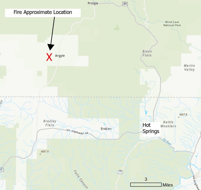
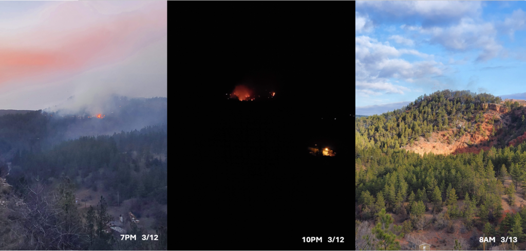
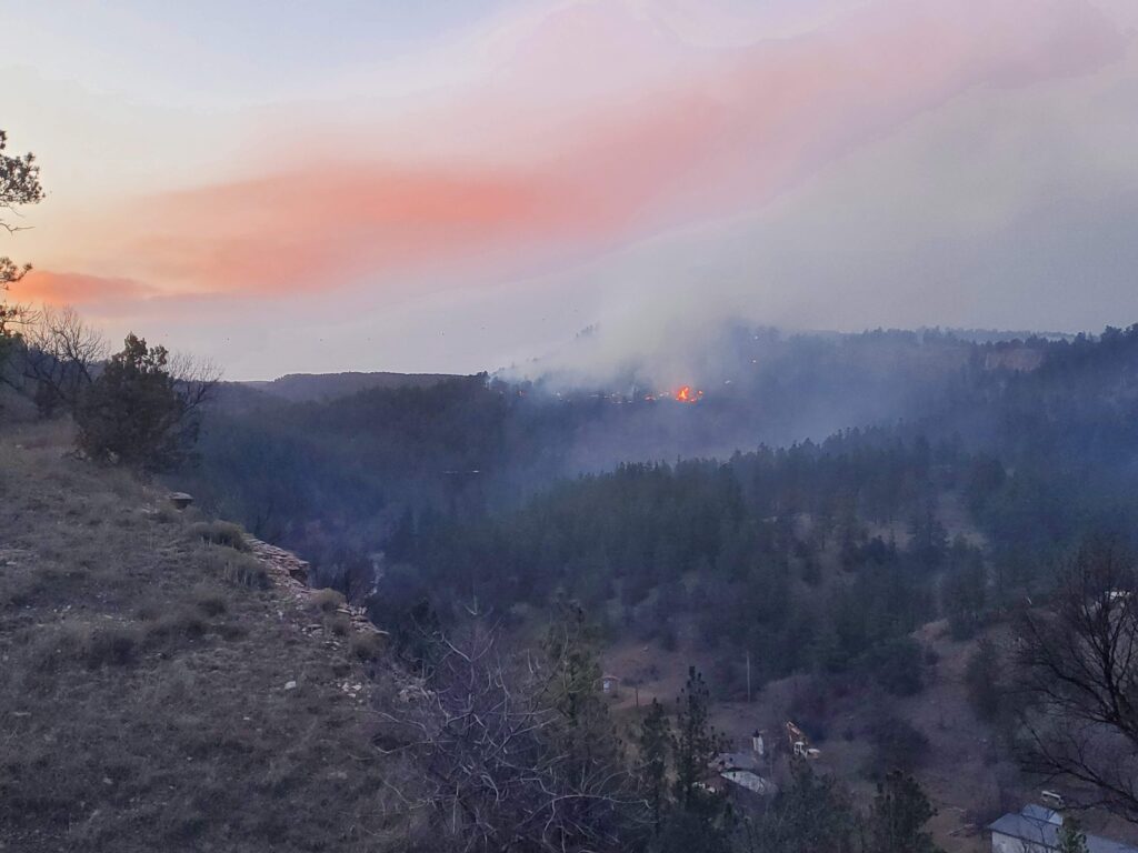
Update 5:53PM: from South Dakota Department of Public Safety “There is an active wildfire burning 2 miles East of Argyle. The Sundance Fire is estimated at 10-15 acres with tree torching. The fire was reported at 3:30 pm. State, Federal, and local resources are on scene along with air support.”
Update 5:32PM: Check out Qury Fire Emergency Operations Center for further information on the Sundance Fire. Evacuation area now includes Mountain Lion Ln, Sundance, Lowell Dr, Lone Elk, South Park Rd, W Argyle Rd and all connecting roads. Go to Pringle Town Hall if evacuated.
Original Post 3/20/2026: There is currently a wildfire west of Argyle. It is approximately four miles north of Fall River County at this time. We will continue to monitor the situation and update Fall River County residents as needed. Check out Custer County South Dakota Emergency Management for more information on this fire.